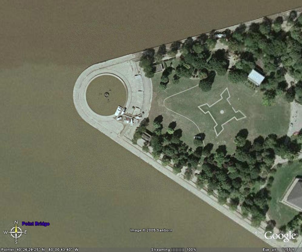
I was messing around with Google Earth. I zoomed in on the point (Point State park) and when I looked at it, there was something out of place. When I zoomed in closer there were boats on the land. And I realized that the picture that they are using for that view is from last year after Ivan hit Pittsburgh.


Ah, Big Brother, now available free! Stay tuned for Google Satellite system, giving you up-to-the-second live feeds on everyone and everything. Need to stalk someone? Go to yellowbook.com, find their address, then look them up in Google Earth and map your escape routes. I wonder if we can get cell phone GPS tracking systems integrated with this. Powered by NSA and DHS.
The pic they have of my house os over six years old…pre-fence. We have had our fence since 1999.